This beautifully detailed 1860 map captures Manhattan, Brooklyn, and surrounding areas during a pivotal era of urban development. The hand-colored ward boundaries and intricate street grid showcase the cartographic artistry of the pre-Civil War period. A stunning piece for history enthusiasts, New York lovers, or anyone appreciating vintage cartography.
This beautifully detailed 1860 map captures Manhattan, Brooklyn, and surrounding areas during a pivotal era of urban development. The hand-colored ward boundaries and intricate street grid showcase the cartographic artistry of the pre-Civil War period. A stunning piece for history enthusiasts, New York lovers, or anyone appreciating vintage cartography.
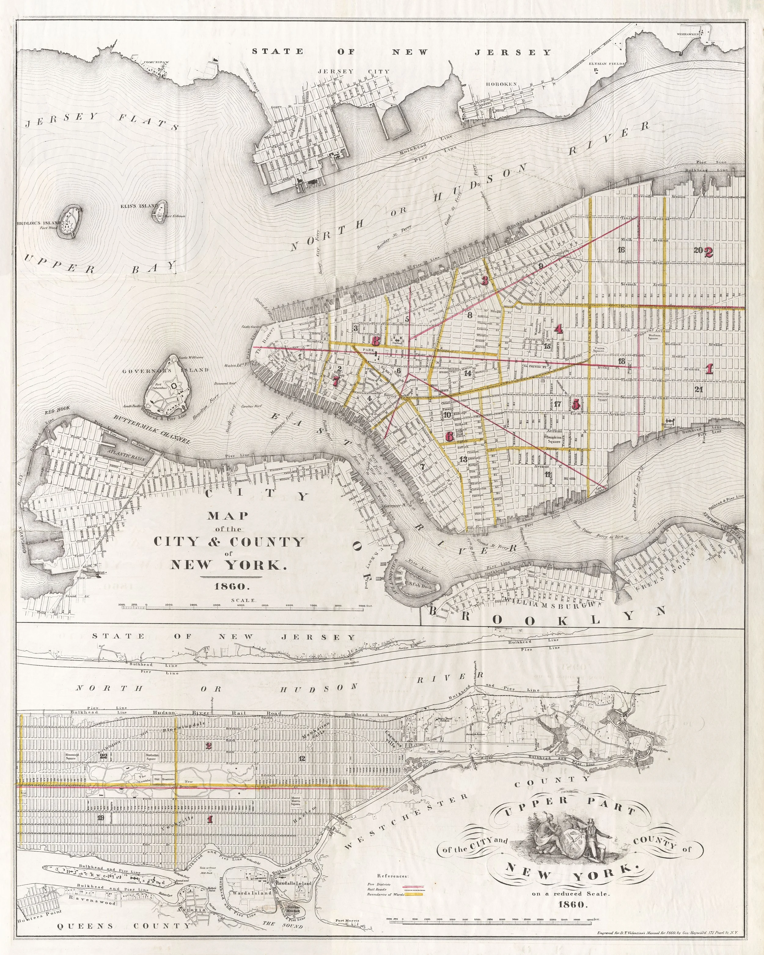 Image 1 of 1