Antique General Map of the United States by J. Bartholomew, 19th Century
$10.00
This beautifully detailed 19th-century map by renowned cartographer J. Bartholomew captures the United States during a pivotal era of westward expansion, showing territories, railways, and state boundaries in soft, hand-tinted colors. The intricate detail includes geographic features, cities, and proposed Pacific railway routes. A stunning piece for history enthusiasts, map collectors, or anyone seeking elegant vintage Americana for their home or office.
This beautifully detailed 19th-century map by renowned cartographer J. Bartholomew captures the United States during a pivotal era of westward expansion, showing territories, railways, and state boundaries in soft, hand-tinted colors. The intricate detail includes geographic features, cities, and proposed Pacific railway routes. A stunning piece for history enthusiasts, map collectors, or anyone seeking elegant vintage Americana for their home or office.
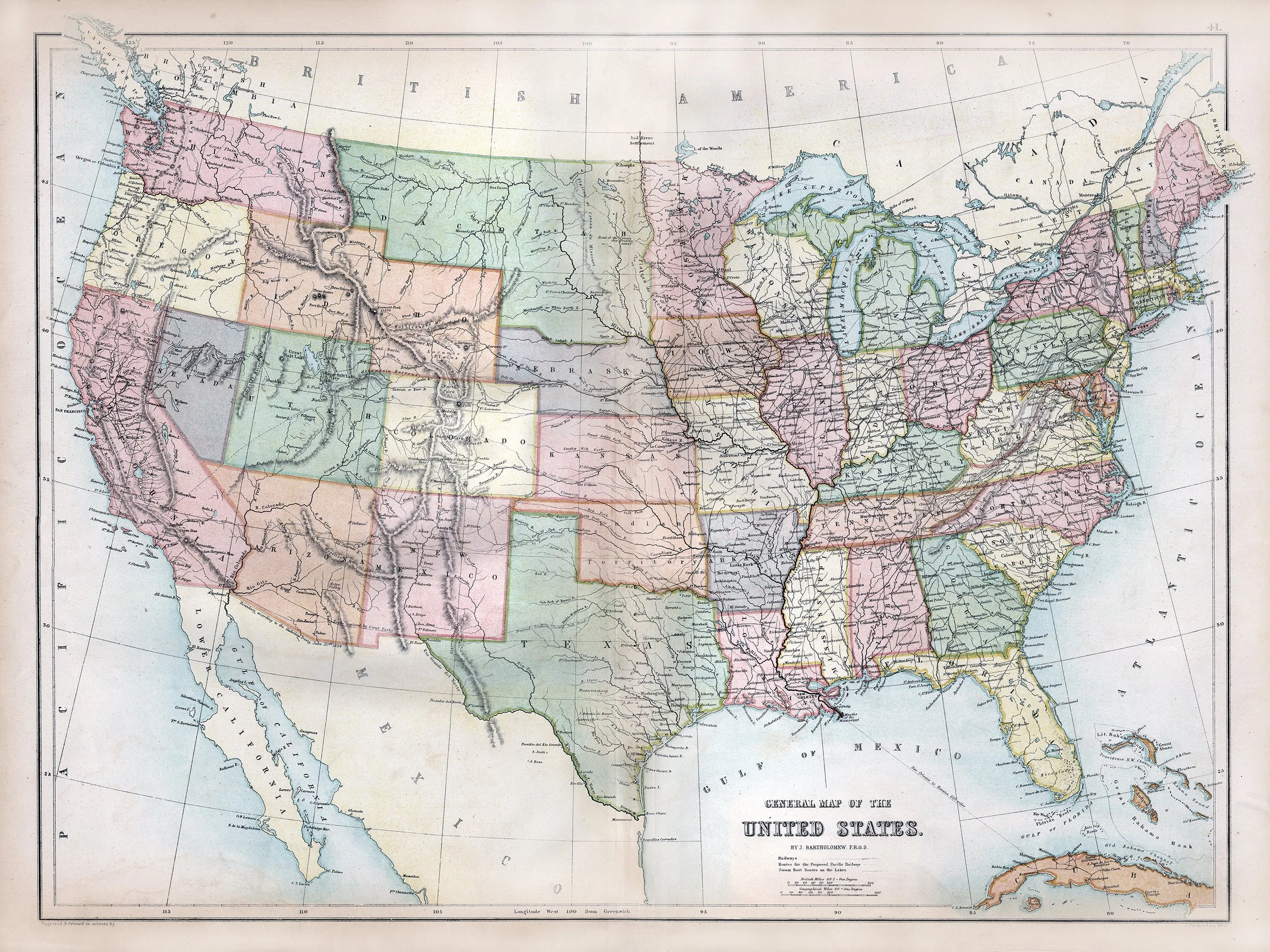 Image 1 of 1