Antique Map of Maine - 19th Century Cartographic Print
$10.00
This beautifully detailed vintage map of Maine showcases the state's counties, towns, waterways, and railways as documented in the mid-1800s. Published in Edinburgh by A & C Black, the map features elegant hand-colored borders and precise engraving typical of Victorian-era cartography. A stunning piece for history enthusiasts, Maine natives, or anyone who appreciates the artistry of antique maps.
This beautifully detailed vintage map of Maine showcases the state's counties, towns, waterways, and railways as documented in the mid-1800s. Published in Edinburgh by A & C Black, the map features elegant hand-colored borders and precise engraving typical of Victorian-era cartography. A stunning piece for history enthusiasts, Maine natives, or anyone who appreciates the artistry of antique maps.
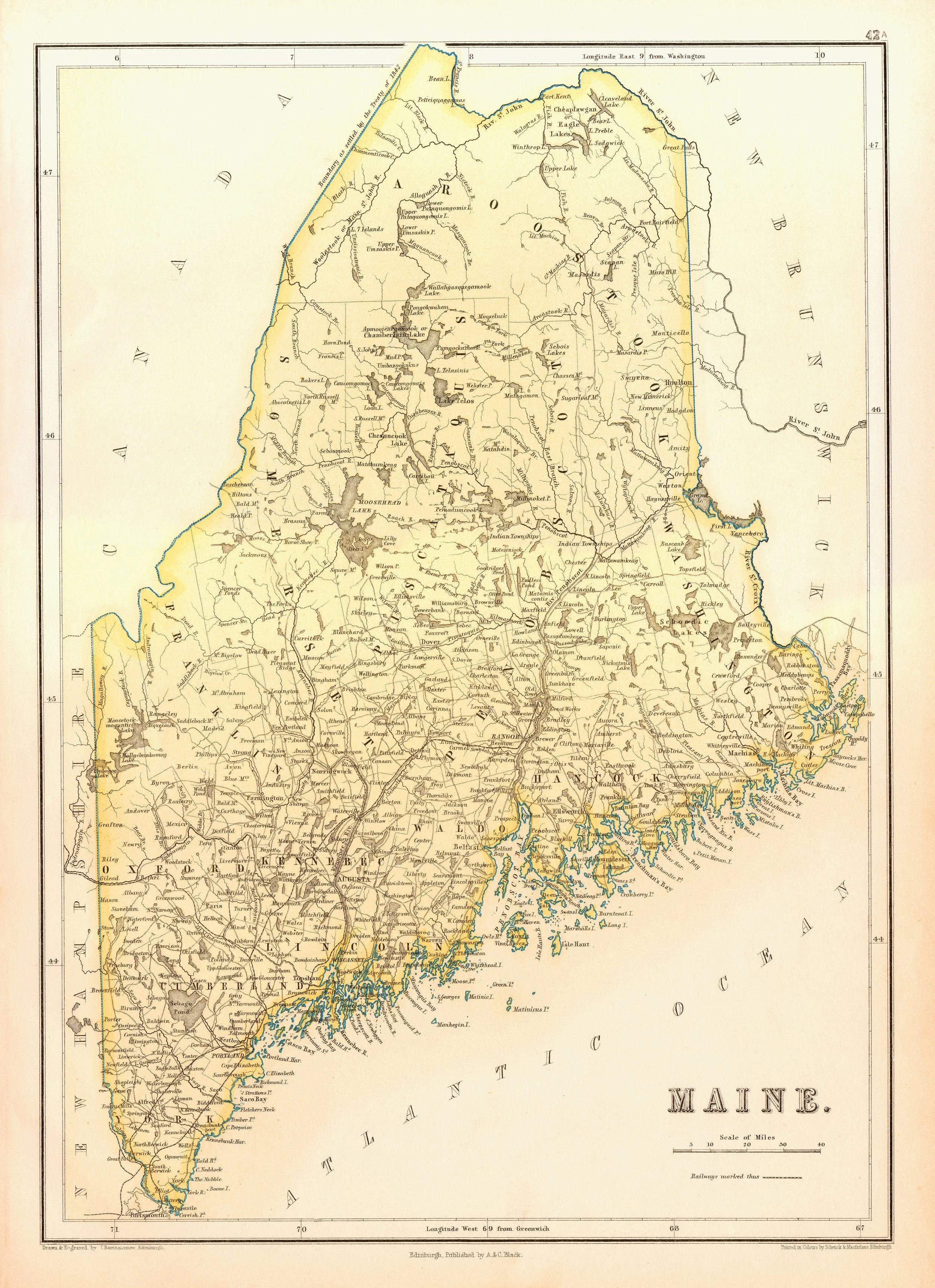 Image 1 of 1