Antique Map of North America - 18th Century Colonial Era Cartography Print
$10.00
This elegant 18th-century map showcases North America during the colonial period, featuring decorative cartouche with a Native American figure and detailed geographical annotations. The map depicts territories including New France, Louisiana, New Mexico, and the British colonies with period-accurate boundaries and place names. A stunning piece for history enthusiasts, geography lovers, or anyone seeking sophisticated vintage wall decor.
This elegant 18th-century map showcases North America during the colonial period, featuring decorative cartouche with a Native American figure and detailed geographical annotations. The map depicts territories including New France, Louisiana, New Mexico, and the British colonies with period-accurate boundaries and place names. A stunning piece for history enthusiasts, geography lovers, or anyone seeking sophisticated vintage wall decor.
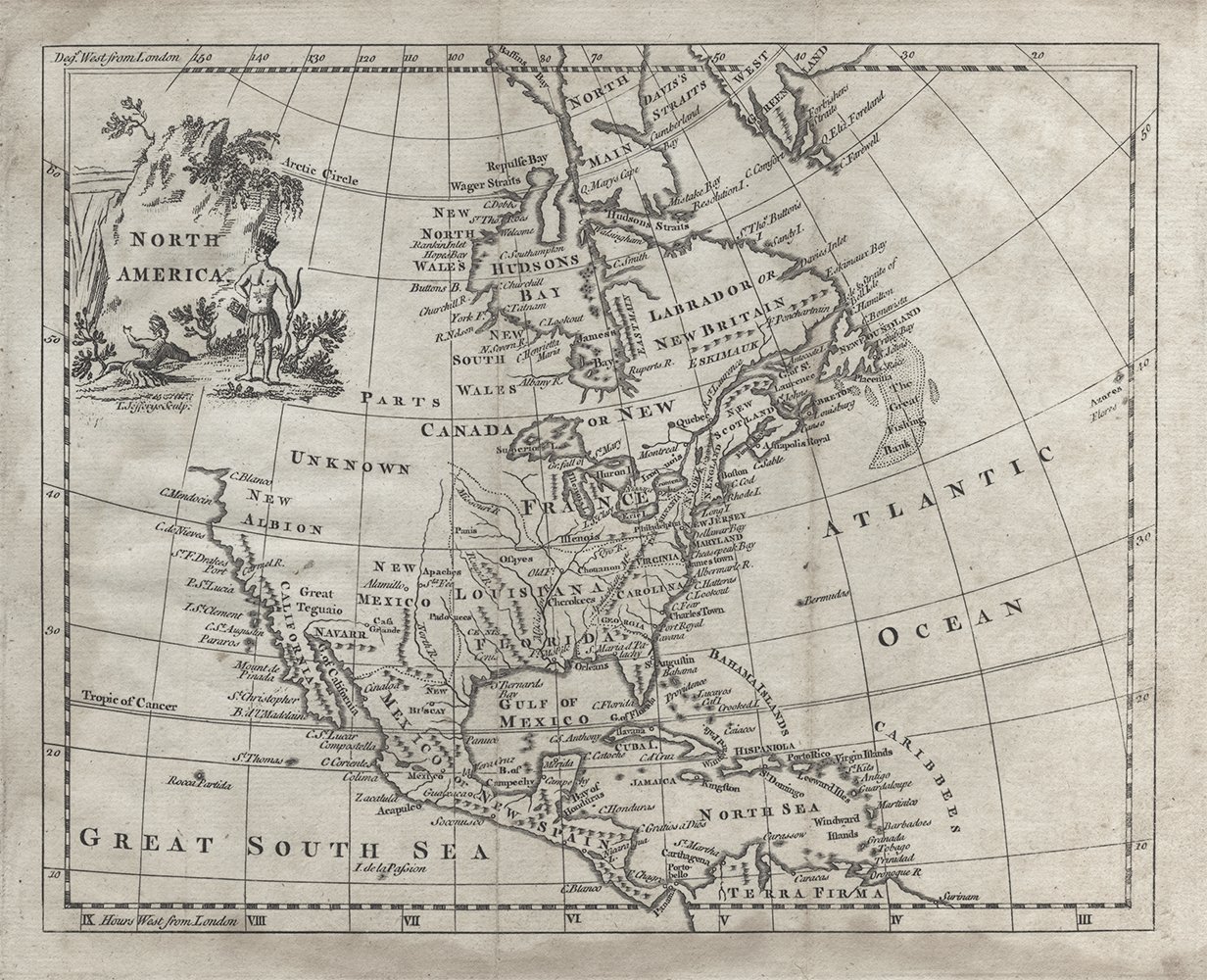 Image 1 of 1