Antique West Indies Map - Victorian Era Caribbean & Panama Railway Chart
$10.00
This beautifully detailed Victorian-era map showcases the West Indies, Caribbean islands, and Central American coastline with elegant hand-colored territories. Published by A & C Black of Edinburgh, it features detailed insets of Jamaica and the Panama Railway route. A stunning piece of cartographic history that brings old-world charm to any study, office, or travel-themed space.
This beautifully detailed Victorian-era map showcases the West Indies, Caribbean islands, and Central American coastline with elegant hand-colored territories. Published by A & C Black of Edinburgh, it features detailed insets of Jamaica and the Panama Railway route. A stunning piece of cartographic history that brings old-world charm to any study, office, or travel-themed space.
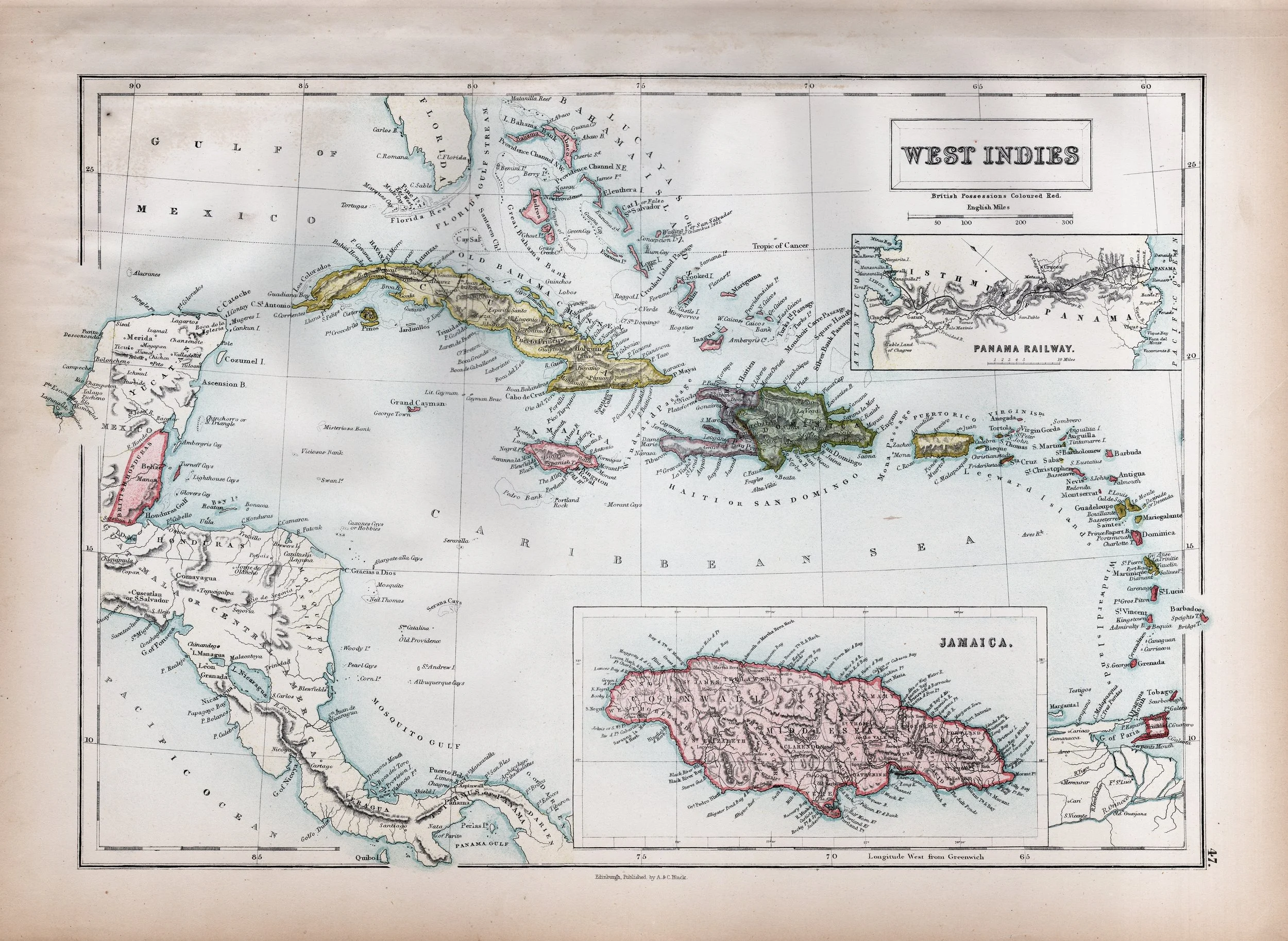 Image 1 of 1