Watson's Atlas Map of England & Wales - Vintage Cartography Print
$10.00
This beautifully detailed Victorian-era map from Watson's Atlas showcases England and Wales with their historic county boundaries rendered in soft, distinctive colors. The meticulous cartography captures cities, towns, coastal features, and waterways with remarkable precision, reflecting 19th-century mapmaking at its finest. A stunning piece for history enthusiasts, Anglophiles, or anyone with British heritage seeking a sophisticated wall accent.
This beautifully detailed Victorian-era map from Watson's Atlas showcases England and Wales with their historic county boundaries rendered in soft, distinctive colors. The meticulous cartography captures cities, towns, coastal features, and waterways with remarkable precision, reflecting 19th-century mapmaking at its finest. A stunning piece for history enthusiasts, Anglophiles, or anyone with British heritage seeking a sophisticated wall accent.
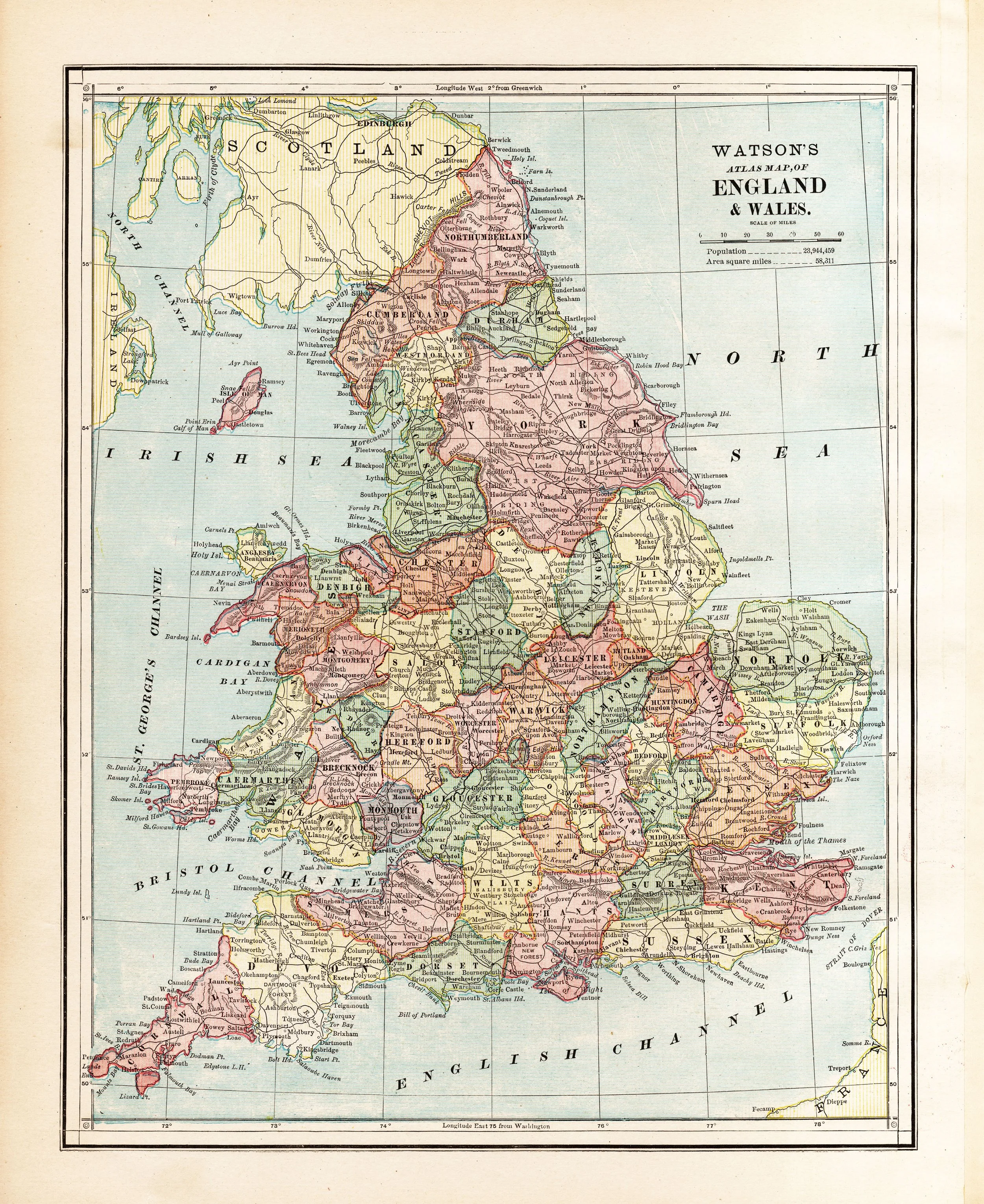 Image 1 of 1